 Mac/2004 Long Mekaba
 Dec/2002 Near Long Selatong
 Oct/2003 Near Long Silat
Some people are trying to promote eco-tourism in this area.
Traditionally, local people welcome visitors from downstream and tourists can enjoy to stay in the villages.
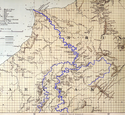
The best way to travel this area is following a longboat, enjoying beautiful view and visitting many villages along the Baram River. You can also enjoy trekking in the forest, visiting waterfalls and mountains and following fishing and huntting.
It is very hard and quite expensive to navigate from downstream by boat. You will do better to visit some village from Miri by car or by flight and travel around by a longboat.
Cost
1) Following a car from Miri to some village RM 80-150 / person. You can also hire a car.
2) Flight to Long Akah or Long Banga from Miri. Two flights a week.
http://www.flyasianxpress.com/site/en/fax/home.jsp
3) Hire a longboat (boat+engine+driver+petrol)
If you luckly find a longboat to follow, you just pay for your seat.
4) People often do not want to claim for your stay and meal in village. But please pay them to express your appreciation.
Attention
1) In villages of Kayan, Kenyah, Saban and Kelabit, you can find somebody who can speak English well.
2) If you visit a village, you need to visit the village chief (or some committee member) at first and ask his permission to stay there. He can help you to find where to stay and somebody guide you.
3) Some villages are following Evangelical Church (SIB). In these villages, drinking alcohol is considered as a bad conduct and formally forbidden. Please follow the local rule.
4) Sunday is Sabbath day. You can only rest.
5) The traffic condition (boat, flight and car) will be strongly affected by whether (rain and water level of the river).
6) If you want take photos in village, please ask permission from the villagers at first.
You may able to touch local culture such as music and dance. Actually, some villages in this area such as Long Mekaba and Long Moh are well known in Sarawak for thier rich cultural heritages. There are so many kind of music and dance. You can try to tell them you are very interesting to see it. However, I can not tell you that you can certainly see it because it depends on who stay in village during your stay and how about thier mood to play (sometimes they are very busy to work).
Anyway, if you are lucky, you may hear an old man playing Sape' (a traditional string instrument) in evening just for his fun, or you may see even a little girl able to play traditional dance so graciously.
※Actually, the biggest problem is how to find a car to visit this area from Miri. I know many telephone numbers of local drivers, but not sure I can write here or not. Still under consideration. Sorry.


